Throughout the state of Vermont, there exists only a sparse 210 acres of land where alpine plants — plants that grow in harsh, high-elevation climates above tree lines — can thrive. Mount Mansfield, the highest point in the state, holds nearly 200 of those acres. And in the face of oncoming climate change and a dramatic drop in snow pack density and days without snow on the top of the mountain, these plants are at risk.
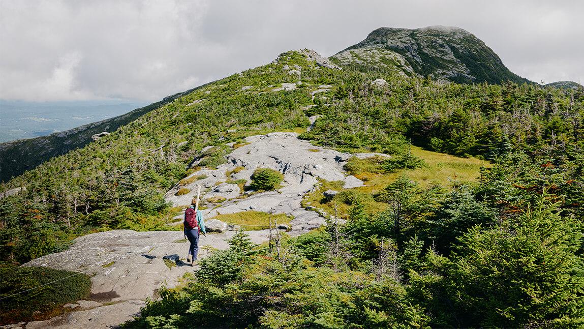
Catherine Wessel, a graduate student in UVM’s College of Agriculture and Life Sciences’ department of Plant Biology’s Field Naturalist Program, spent the summer studying the minute details of these plants at the top of Mansfield, one square meter at a time.
“Nonvascular plants (like mosses) like staying really low to the ground and so they’re less exposed to the elements,” Wessel said. “But there are fairly few vascular plants that can survive in the Alpine just because it is such an extreme area. There are probably 15 common vascular plants in the alpine regions of Vermont.”
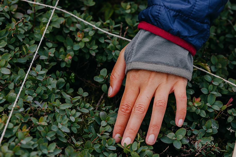
Two of the more common alpine plants that grow on Mansfield are bilberries and lingonberries, both low-growing shrubs that produce edible berries. Lingonberries have been used to make jams and jellies for centuries, with lingonberry jam being a staple in Nordic countries.
To analyze alpine plants on Mansfield’s summit, Wessel uses a simple square meter made from PVC piping. She places the square on a randomized spot, called a quadrat, and places another, smaller square inside.
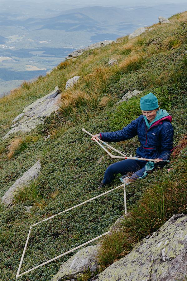
“What I’m measuring is species frequency and cover for vascular plants, bryophytes, and lichens” Wessel said. Combing through the quadrat and the sub-quadrats, Wessel continually asks one simple question: more or less? Does this quadrat section have more or less than 50% vaccinium uliginosum (bilberry) coverage? If it’s more than 50%, does it have more or less than 75% coverage? This back and forth calculation continues until Wessel finishes the quadrat, determining the coverage for each species present, and moves onto the next one, completing just a handful per day.
“I’ve done 65 quadrats now. It’s incredibly slow going,” Wessel said. “I’m driving over an hour from Burlington and then often hiking about another hour to get to the site.” At her current rate, it would take Wessel decades to measure the alpine plants on Mansfield. But the goal of her research isn’t to analyze all 210 acres, but to sample a representative area and expand on an earlier study on alpine plants published in 1995 by William Howland, which has been monumental in the understanding alpine and tundra plants on Mansfield.
“(The 1995 study) was comprehensive, especially with its locations. Some of the locations I found the exact spot and was able to set up directly there,” Wessel said. “And for those that I couldn't find a site marker, I was able to meet with Howland and he directed me to the areas that he studied. Hopefully we'll be able to look at these trends over the last 30 years having this as a baseline. Whereas if you if you don't have an original study to go off of, it's still interesting to see what the current state is. But there's less of a comparison that you're able to do.”
And while the 1995 study was comprehensive — Howland measured elements like soil depth and character, pH levels, and surface morphology like the slope and aspect of monitoring sites — Wessel explained that it was not complete in its scope.
“There wasn’t really any analysis that was completed because it was a contract to complete data collection,” Wessel said. “Along with species data, there’s also environmental data that was collected, which I’m also collecting now. It will be interesting to do analysis on that and figure out if there are some species that are more likely to grow in association with others, or if some are really impacted by the aspect of the slope or the steepness of the slope and how much soil depth impacts species present.”
Some key data trends Wessel is incorporating into her research is snow, specifically snow pack and days without snow on the top of Mansfield.
“Almost 30 years have gone by since the the study from 90s, and looking at the climate data for Mount Mansfield, it's incredible to see the amount of difference, especially in the snow pack since the 90s,” Wessel said. Snow pack has dropped considerably over the last three decades, and other researchers at UVM studying snow pack know the risks of warming winters.
“Downhill skiing, with the help of snowmaking, will likely remain largely viable in Vermont up until approximately 2050,” the Gund Institute’s and The Nature Conservancy’s Vermont Climate Change Assessment said. “By 2080, the Vermont ski season will be shortened by two weeks (under a low emissions scenario) or by a whole month (under a high emissions scenario), and some ski areas will remain viable.”
Wessel’s data also shows that since 1991, Mount Mansfield has experienced a drop in snow coverage. Throughout the 90’s, Mansfield experienced a steady 200 days of snow coverage. Now, it’s dropped to just over 160, posing some significant problems for alpine plant life.
“A loss in snow pack exposes these plants to way higher amounts of radiation from the sun, wind in the winter, and harsher conditions because the snowpack insulates them,” Wessel said. “The impact of losing these days of snowpack would likely impact some of these communities.”
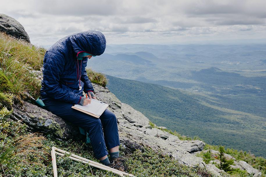
Now that Wessel’s field season has wrapped, she’ll spend the next portion of her research analyzing data and creating education materials. For this project, she partnered with the Green Mountain Club, a nonprofit dedicated to maintaining Vermont’s mountain lands and trails.
“Rather than just writing an academic paper or just analyzing the data, the Green Mountain Club and UVM want to figure out what ways make this more interesting and accessible to people,” Wessel said. “How do you create a compelling story with what this data is telling us, not just about Mansfield but our alpine zones across New England, how they’ve been changing, and what might continue to happen there?”