 |
||||
Strip Mine, Quarry, or Gravel Pit (75)
From Anderson et al. (1976):
Those extractive mining activities that have significant surface expression are included in this category. Vegetative cover and overburden are removed to expose such deposits as coal, iron ore, limestone, and copper. Quarrying of building and decorative stone and recovery of sand and gravel deposits also result in large open surface pits. Current mining activity is not always distinguishable, and inactive, unreclaimed, and active strip mines, quarries, borrow pits, and gravel pits are included in this category until other cover or use has been established, after which the land would be classified in accordance with the resulting use or cover. Unused pits or quarries that have been flooded, however, are placed in the appropriate Water category.
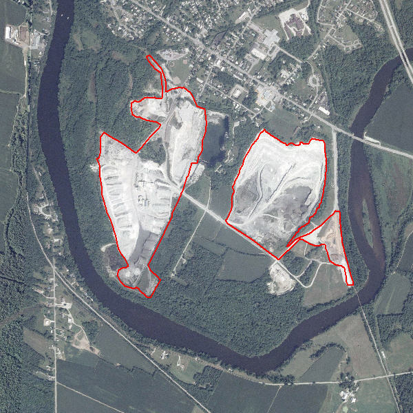
Gravel Pit (75)
Gravel Pit (75)