Forest
Canopy Research Tower at Proctor Maple Research Center in Underhill, VT
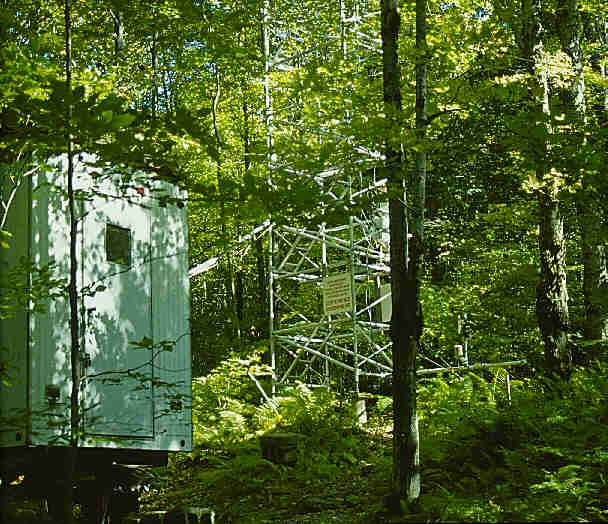
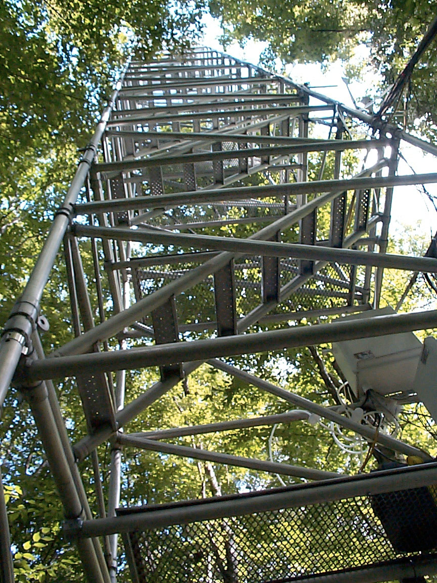 In Fall 1991 the VMC erected a 22 meter Upright aluminum walkup tower in a northern
hardwood stand at the Proctor Maple Research Center in Underhill, VT. In
addition to providing access to the foliage of a variety of hardwood species,
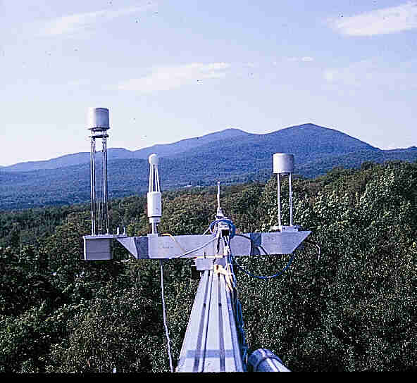
the tower hosts meteorological stations at 0.5,
7.5, 17, and 24 meters above the forest floor. At each level, wind speed and
direction, temperature, relative humidity and surface wetness are continuously
monitored and logged as 15 minute averages to a Campbell 21X datalogger in the
instrument shelter. Total solar irradiance and photosynthetically active radiation
(PAR) are measured at 22 meters, only, and also logged as 15 minute averages
to the same datalogger.
In Fall 1991 the VMC erected a 22 meter Upright aluminum walkup tower in a northern
hardwood stand at the Proctor Maple Research Center in Underhill, VT. In
addition to providing access to the foliage of a variety of hardwood species,
the tower hosts meteorological stations at 0.5,
7.5, 17, and 24 meters above the forest floor. At each level, wind speed and
direction, temperature, relative humidity and surface wetness are continuously
monitored and logged as 15 minute averages to a Campbell 21X datalogger in the
instrument shelter. Total solar irradiance and photosynthetically active radiation
(PAR) are measured at 22 meters, only, and also logged as 15 minute averages
to the same datalogger.
Over
the years a number of research projects have been conducted using the forest
canopy research tower (tower) and surrounding facilities. Topics of research
have included ozone, carbon dioxide, photosynthesis, and UVB radiation. Although,
not being monitored currently, from 1993-1999 ozone was measured during summer
months at the same four levels where meteorological data are currently collected.
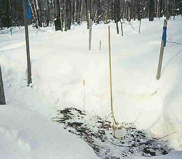
Monitoring
of soil temperatures within a northern hardwood stand began in January 1993.
Two sets of paired soil temperature plots (4 plots total) were established near
the forest research canopy tower. Multi-point averaging thermocouples were installed
in each of the four plots at 2 cm above, and 5, 15, and 30 cm below the soil
surface. Soil temperatures are continually read and measurements are averaged
and recorded as a 15 minute mean to the Campbell 21X datalogger in the instrument
shelter. From January 1993 until April 2001, during winter months, one treatment
plot of each pair was kept free of snow while snow accumulated and melted
naturally on the second plot. While plot treatments did not continue during
the 2001-2002 winter, soil temperatures on all plots are still being recorded.
A
prototype laser instrument for measuring carbon
dioxide and water vapor was tested atop the tower during July-August 2001. This
cooperative project between Physical Sciences
Inc. of Andover, MA and the University of Vermont School
of Natural Resources was designed to field test this instrument under real-world
conditions. It is anticipated that the instrument will receive a second year
of field testing at the tower during summer 2002.
In
Fall 2001 a networked video camera (Mount
Mansfield Cam)was mounted atop the tower by staff at PMRC to provide a continuous
view of Mt. Mansfield. This project was possible because a new fiber optic cable
was installed in 2001 linking the instrument shelter, at the base of the tower,
with the PMRC Laboratory.
Colchester
Reef
Mt.
Mansfield (west)
Ranch
Valley
PMRCAQ
Home
Meteorological
Instruments